OF THE
TOP END
"I had ambition not only to go further than any one
had been before,
but as far as it was possible for man to go."
Captain James Cook
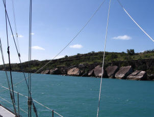
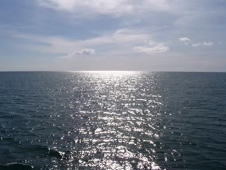
The Cape York Peninsula from Cooktown is one
of the wildest and least populated areas of Australia. From here
the inland terrain turns to a low, hot, dry dusty isolation while the Coral Sea
is strewn with isolated reefs.
It is an area not recommended for
those inexperienced in coral navigation
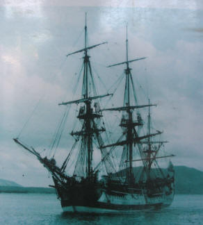
In 1770 Capt. James Cook came to grief when his ship s/v H.M.S
Endeavor became trapped inside the encroaching reefs holing his vessel
on a coral ridge running east and west for 5nm, just south of Cooktown. That reef is now
known as the Endeavor Reef.
Having freed his ship from the reef and jettisoning his cannons, he and his men struggled into the
river at Cooktown and there spent 48 days repairing and refitting as
well as to rest the sick and refill the larder.
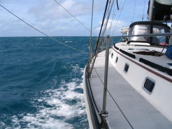
 It is hard to imagine sailing these waters without GPS
interfaced to computers with good
electronic charts, a depth sounder, knot meter, and accurate compass not
to mention good weather reports over the SSB radio. Coming into
the Endeavor River at Cooktown even for s/v Ariel with all her modern
navigational equipment was a bit dubious squeezing between the mud
flats, the shore and sand bars.
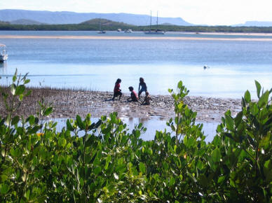
It is hard to imagine sailing these waters without GPS
interfaced to computers with good
electronic charts, a depth sounder, knot meter, and accurate compass not
to mention good weather reports over the SSB radio. Coming into
the Endeavor River at Cooktown even for s/v Ariel with all her modern
navigational equipment was a bit dubious squeezing between the mud
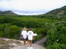
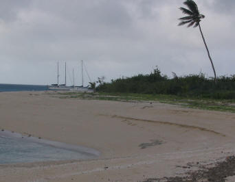
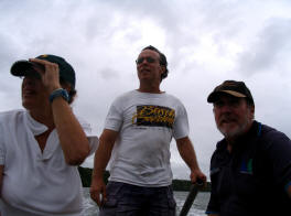
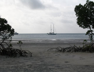
flats, the shore and sand bars. S/v Ariel at anchored in Capt. Cooks spot across from Aboriginal children playing in the mud flats in the Endeavor River, Cooktown.
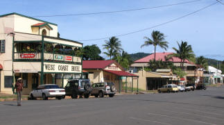
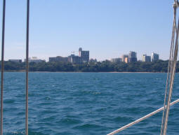
Cooktown is the last town on the coast for the next 400nm to the
northern most tip, the last stop for provisioning until after
rounding Cape York.
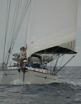
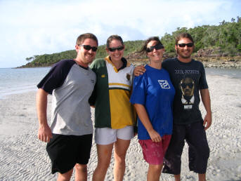
We meet up with our Australian friends on S/v Arnak we had met at Hope
Island. Geoff built his 45' Spray, a boat with similar speed
as s/v Ariel, so we decide to sail off together into the desolate north.
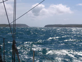
Wind SE 20-25
Seas 2m
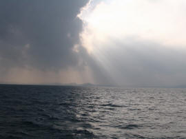
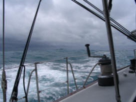
It is a dark overcast departure from Cooktown with the prospect of Cyclone Pierre looming 140km east of the Top End. It has been down graded to a Low, so time to leave. The seas are rough and a bit uncomfortable until after Cape Bedford when we fall off to a more favorable heading. Not accustomed to sailing in tandem with another boat, we found sailing with s/v Arnak and communicating over VHF radio a great comfort.
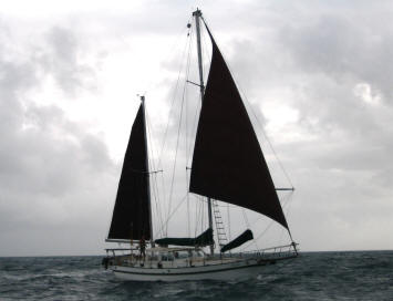
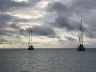
S/V ARIEL
Two boats on a similar mission - to
reach the Top End
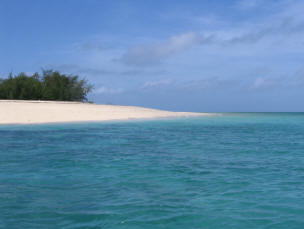
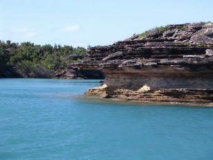
CAPE FLATTERY
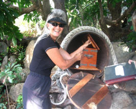
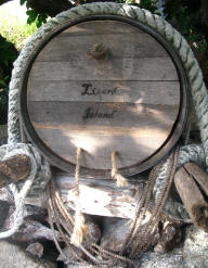
LIZARD ISLAND
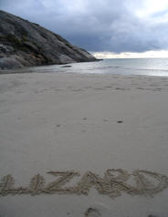 May 24, 2007 Cape Flattery to Lizard Island 20.2nm
It was a short and beautiful sail to Lizard Island.
In 1770, while repairs to Capt. Cooks ship were being made back in Cooktown, he and a small crew made a similar sail to Lizard Island, but in Endeavor's launch, to try and find a passage to deep water, clear of reefs.

Imagine how Capt. Cook felt climbing to this high
point on the island, only to find "a reef of rocks...extending farther
than I could see, upon which the sea broke in a dreadful surf."
Cook found a narrow break in the reefs which offered an escape to the
open sea. Today that channel is called Cooks Passage.
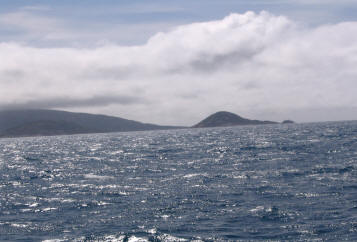
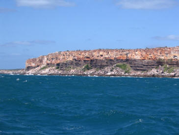
CAPE MELVILLE
 May 27, 2007 Lizard Island to Cape Melville 69.9nm
Winds SE 15-20 then SE 20-25 at the Cape
Seas 1/2 m
It was a great day sailing wing and wing, wind at our back with smooth seas and only a few light squalls to wash the salt off the decks.
We are 6nm behind s/v Arank when our radio crackles that they have caught a huge Mackerel and we are invited to dinner. It is too far to get to Flinders so we round the cape at Cape Melville and anchor. Deserted and desolate Cape Melville
We got 40+kt tailwind gusts when
leaving and a boat speed of 4.5kts with
NO SAILS OR NO ENGINE
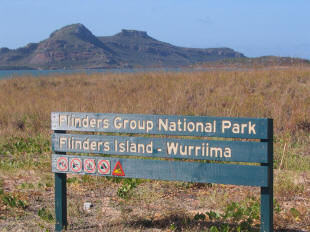
FLINDERS GROUP
May 28, 2007 15.8nm Cape Melville to Owens Channel
Aapa spit
Wind SE25-35 The mountain makes it's own weather at Cape Melville
Seas 1/2 m
 Sailing with jib only, short day into Owens Channel past many beautiful
white sandy beaches and desolate low scrub, much like
Sailing with jib only, short day into Owens Channel past many beautiful
white sandy beaches and desolate low scrub, much like
Baja Mexico.
Aapa Spit
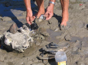
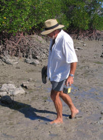
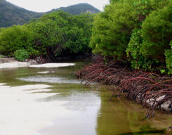
Geoff of s/v Arnak braves muddy shores and croc infested mangroves to
collect tasty oysters from the rocks.
A MAGNIFICENT anchorage and good nights sleep.
No Croc's seen!
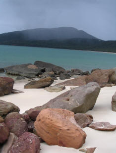
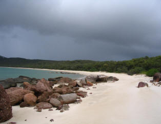
MORRIS ISLAND
May 29, 2007 Flinders Group to Morris Island 58.2nm
Winds SE20-25
Seas Flat calm
On the way to Morris Island under protection of small sand islands and
Fife Reef, the seas flattened
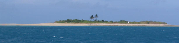
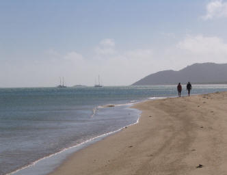
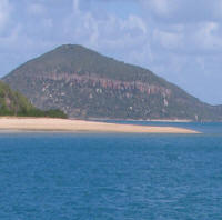
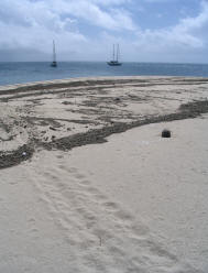
 Morris,
a coral cay, takes 20 min. to walk around & an excellent anchorage
if behind the island...... not the spit.
Morris,
a coral cay, takes 20 min. to walk around & an excellent anchorage
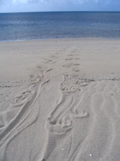
if behind the island...... not the spit. Pelicans, eagles, turtles tracks - it was worth it!
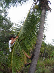
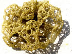
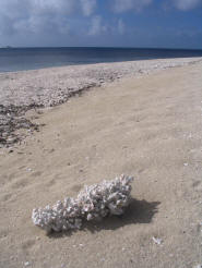
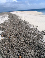
 For
a means to support shipwrecked crews of years ago, coco palms were
planted for the nuts while sisal trees, which produced long sticks, were
to knock down ripe coconuts.
For
a means to support shipwrecked crews of years ago, coco palms were
planted for the nuts while sisal trees, which produced long sticks, were
to knock down ripe coconuts.Only one palm survived
Sisal trees
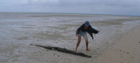
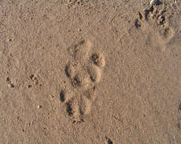
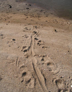
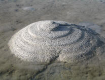
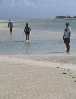
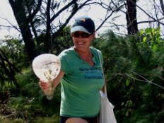
Gayla spots the first CROC!
But no one else is fooled !
LOCKHART RIVER
May 30,2007 Morris Island to Lockhart River 57.7nm
Wind SE 20-25
Seas 1/2m
We have a usual fast passage which has become the norm with strong winds
and calm seas passing between reefs, one with the wicked name,
Waterwitch Reef. We are anxious to reach Lockhart, a very
navigable river with good protection from the SE winds. We jibed
and reefed coming around the headland then slipped into the entrance,
which was easy against the wind on a flood tide, since it is not a
weather shore this time of year. We time it right and anchor deep inside
Lloyd Bay in 4m of water.
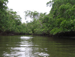
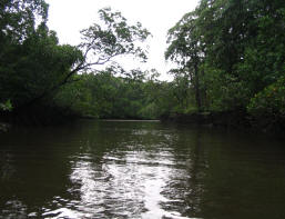
Our Crocodile search proves futile as we cruise the inlets and tiny
waterways flowing into the river.
STILL NO CROC'S
We do have cell phone coverage for internet connection from
an Aboriginal mission nearby.
CAPE GRENVILLE
Wind SE 15-20
Seas 1 then 2m around Cape Waymouth at Portland Roads
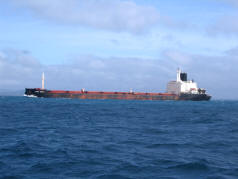 It
was a long day through shipping lanes and intermittent squalls.
It
was a long day through shipping lanes and intermittent squalls.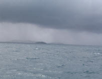
The entrance to Margaret Bay was a bit scary as the Bremner Shoal almost touches a reef which we had to squeeze in-between. When the depth starts to drop to 3m it is necessary to head straight for the reef. Not a nice feeling.
Anchored in Margaret Bay
we meet up with two prawn trawlers and the
crew. It is not a good season, their load is small, with not even
enough to cover their fuel expense.
Their local advise was to give the Escape River a miss as rocks and
floating pearl floats cause hazards. We later heard 2 cruising
boats discovered each to be true.
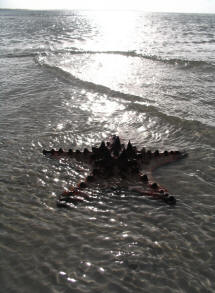
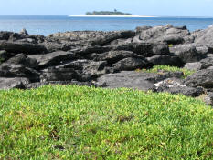
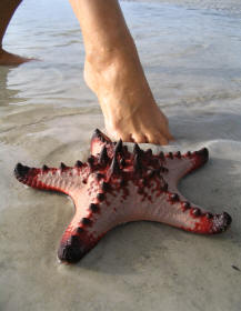 Margaret Bay had some of the most
interesting marine life.
BOY DONG
&
LITTLE
BOY DONG
ISLANDS
Little Boy Dong off in the distance was a fun dinghy ride across the
channel with fast flowing current
Jan finds a fishing boat light bulb, still in tact,
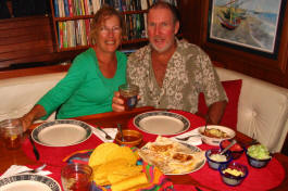
after washing up on shore and we celebrate finding lots of
treasures with a big Mexican meal aboard s/v Ariel
Wind 15-20
Seas 1m
We are still getting good winds and making good time while dodging rain squalls. Passed Escape River and glad we had given it a miss as it looked very ominous and foreboding.
 14nm
NW of the Escape River is a short-cut between the mainland and Albany
island making it a very fast short cut when the tide is running in our
favor.
14nm
NW of the Escape River is a short-cut between the mainland and Albany
island making it a very fast short cut when the tide is running in our
favor.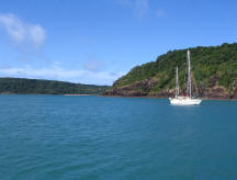
We entered the cut at 2 hours after high tide. It was bumpy at first just after Ariel Bank but then a nice short fast passage to a calm anchorage around the corner.
S/v Arnak anchored in Shallows Bay
ROUNDING CAPE YORK
June 4, 2007 Albany Passage around Cape York
to Seisia 22.4nm
Wind SE 10-15
Seas calm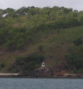
 "Intense Gratification"
Top End of Australia
800 nautical miles to go!
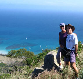
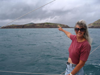
Capt. Cook monument
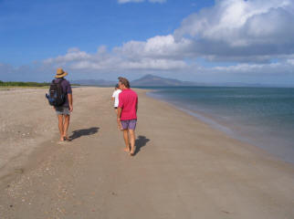
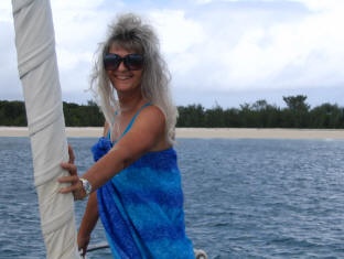
Gayla pointing to Cape York lighthouse
GULF OF CARPENTARIA
NIGHT OF TERROR
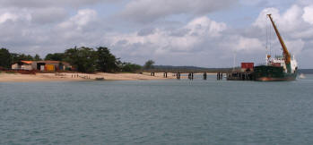 Seisia,
an outpost to the Aboriginal settlement of Bamaga inland about 8km,
where the supply ship docks twice a week. It is just around the corner
of Cape York.
Seisia,
an outpost to the Aboriginal settlement of Bamaga inland about 8km,
where the supply ship docks twice a week. It is just around the corner
of Cape York.We stock up with fresh vegetables and fruit, the first we have seen since Cooktown over two weeks ago, but for an exorbitant price.
We motor out of Seisia past Parau Is. with s/v Arnak 2 hours ahead. It is hot and sunny.
s/v Arnak offers us fuel if we run low as we joke about having to motor all the way to Gove
but thrilled it is calm with promises of an easy crossing.
'Because Cape York Peninsula is to windward, sailing the lee is one of life's great experiences'
All sails up. Engine off after 6 hours of motoring. Now if the winds would just pick up!! We
have a light wind from the west and notice waves coming from our port bow while seas
begin to grow off our stern. By evening we are rolling and surfing along at 5.8kts as we sail
into the night.
'When the weather is calm to light on the Coral Coast during winter, the Gulf of Carpentaria can create it's own weather patterns, the worst being a south-west gale.'
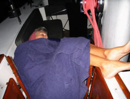
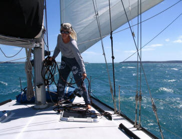
Gayla 'off watch' trying to adjust to deteriorating conditions while wind and seas begin to rise
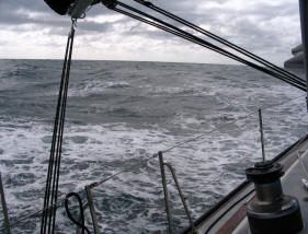
June 7, 2007 Middle of the Gulf of Carpentaria
making any work on deck difficult. We use our harnesses as the boat is pitching and rolling,
the wind screaming and we begin to take water over the bow. s/v Arnak is now 14 nm ahead.
'With the coast left astern seas can rapidly build up'
we came from and where we are going. We are unable to contact s/v Arnak on VHF so ask if
they have their position but they are not allowed to divulge that information. The conditions
continue to deteriorate and we are now concerned about s/v Arnak.
'It is thus possible to have that dream sail turned into a nightmare of discomfort.'
The
seas are now so confused with huge rollers coming up on our stern at
least 15 feet high,
then
surfing under Ariel making horrible crashing noise, while bow
waves from the port side
are crashing over
the foredeck and up over the dodger. As our second night begins it
is
terrifying. The
towering waves rushing up to our stern look like mountains.
The noise is
unrelenting, the
fear mounting. 3:00AM we hear a faint signal on the VHF from s/v Arnak,
"We are taking water over the bow, this is really bad."
"Yes, it is not
nice" responds Steve and no more is heard. It
is just too uncomfortable to
carry a
conversation but at least we now know they are still there and we are
not in this
alone. It is
a great consolation.
We spent 25 hours in these most horrendous, terrifying conditions!
By daybreak we are easing into Gove . We are never so happy to have our feet on the ground. S/v Arnak came in 4nm ahead of us. It was here we would part company as they will head further north in the Wessel Islands as we head for Darwin.
AND WE NEVER DID SEE ONE SINGLE CROC!!
STILL 400 NAUTICAL MILES TO GO!
Gove if not even half way to Darwin. We still
have another couple over night sails and another Gulf to cross as well
as the infamous..........Hole in the Wall....... otherwise know
as the Gugari Rip. First we must clear Bonnar Rocks and shoals,
head NW to round Cape Wilberforce, then between two islands and
cross the huge Donington Sound before entering the Hole all the while
taking meticulous calculations concerning the tides.
We have 2 1/2kt current with us, SE20kts doing
9.5kts across the Donington Sound in 2 meter seas.
We must double reef the main to keep from arriving at the Hole in the
Wall too soon also
tack for 2 hours to slow s/v Ariel down.
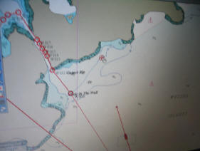
Inside the Hole in the Wall it is 64m wide at it's
narrowest with 9 meters of water.
Timing is crucial.
We enter on a flood-neap with 2 1/2 kt current with us.
Winds SE15-20
Seas 3m
It is another "overnighter" but the thought is worse than the passage.
Coupled with a report that another high is pushing up off the Great
Australian Bight, a similar report we heard before crossing the Gulf
with predicted SE30+ in a couple days, makes us anxious to just "go for
it".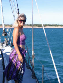
It is a restless passage, alternating 3 hour watches in the night but a
pleasant sunny day as we arrive at Corker Island . We are
all alone anchored off the low, dry scrubby Summerville Bay with
beautiful white sand beaches.
Now we have no AM radio signal
to listen to ABC news and weather on Channel 1062. We are in
the isolated north of Arnham Land, having crossed over into the Northern
Territory.
Wind SE 10-15
Sea 1/2 to 2m then calm
 It
was smooth sailing on a broad reach after 2m seas for one hour off
Vashon Head.
It
was smooth sailing on a broad reach after 2m seas for one hour off
Vashon Head.
Then we are becalmed!
Is this the CALM BEFORE THE STORM??
Our anxiety levels have gone haywire after the bashing across the Gulf
so now we are even skeptical about the calms with a prediction of
30+knots of wind tomorrow our last day.
Wind 5 to 25 Those predictions are never right!
Seas calm to 1m
We have the big Van Diemen Gulf to cross once around Cape Don with predicted high winds so do not sleep well. We must get up at midnight to make sure we leave 4 hours high tide in Darwin.
It is dead calm from the anchorage until we round the Cape, then immediately
hit 22kt head winds. Only the first part of the Gulf was rough then behind Melville Is. and
shoals it is smooth sailing through the night.
By daylight we are flying along at 8.9kts with helm over hard, sailing
on the wind with degrees of rudder, beating, heeled over,
skimming across shallows off East Point . Our
chart shows '0' water under us but because of 7m tides we are coming in
with 6m under our keel.
By 1PM we see Darwin in the distance. It is a beautiful sight and
a most gratifying sense of accomplishment.
WE MADE IT!!!
S/v Athena